Bowfell & Crinkle Crags

Saturday, 19 April 2014
9.8 miles/15.7km
4450ft/1357m ascent
Trail 100 #33
Wainwright #141 & #142

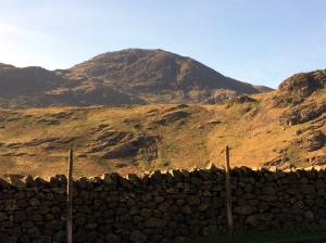
Another glorious day and we drove to the Langdale valley arriving before it got too busy. Crinkle Crags (2,818ft/859m) and Bowfell (2,959ft/902m) are often walked together and our plan is add a couple more mountains; Pike O’Blisco (2,313ft/705m) and Cold Pike (2,300ft/701m) to the route.

Pike of StickleLangdale Pikes

It was still cold as we set off past a small wood up the slopes of Pike O’Blisco.  This is a pretty mountain with a distinctive stepped summit and a great view of the Langdale Pikes across the valley.

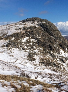
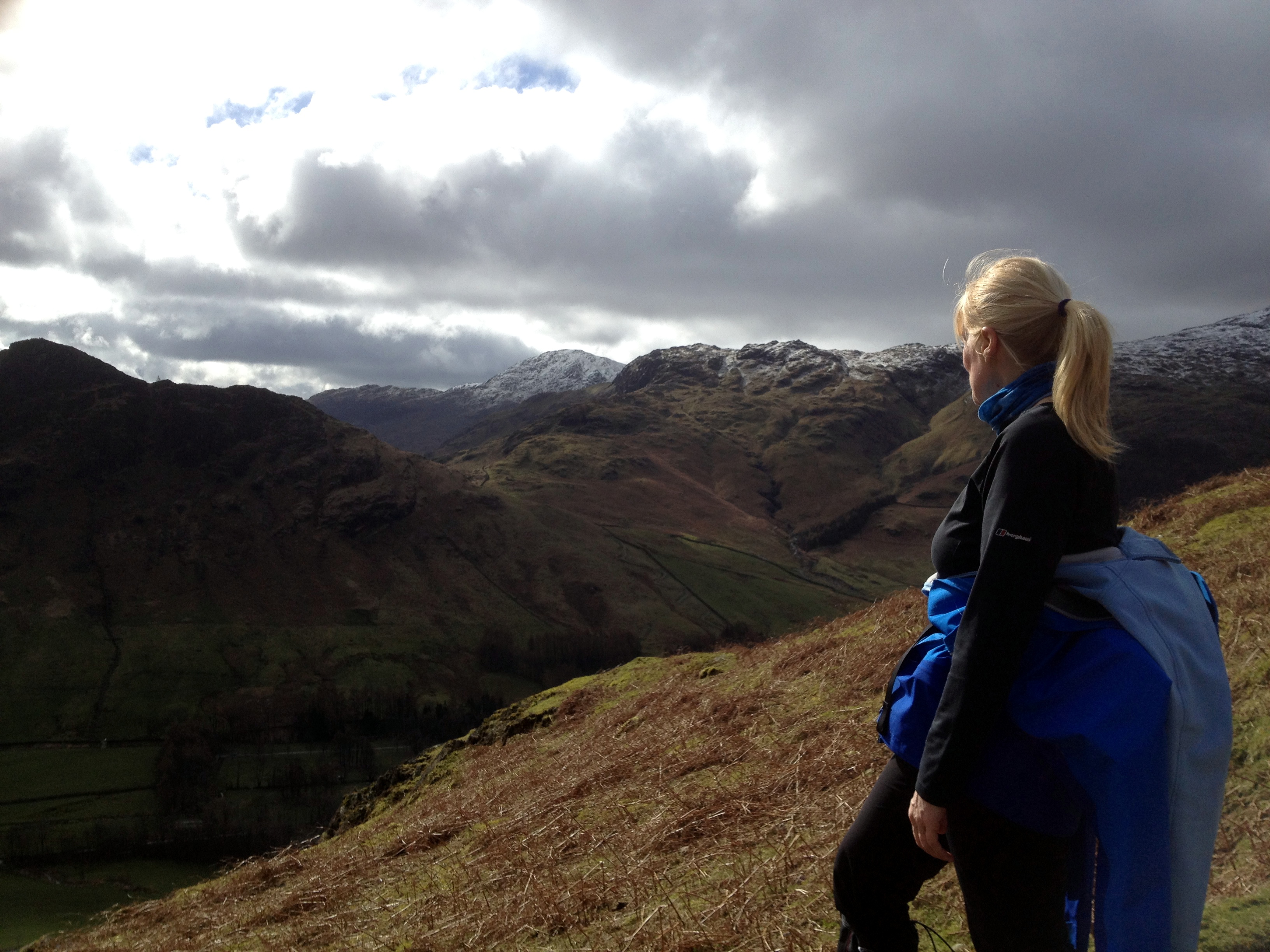
From the top of Pike O’Blisco you can see Wetherlam (2,503ft/763m) and the hills we climbed a few days ago and all of our route for today.  The knobbled ridge of Crinkle Crags getting closer with each step.

Pike O'Blisco Summit

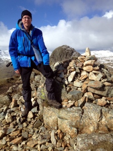
A quick descent to Red Tarn and then back up to Cold Pike on the opposite side of the col. Although only a short detour from the busy main path, Cold Pike was a quiet place to stop for a snack.

Cold Pike SummitBowfell from Crinkle Crags

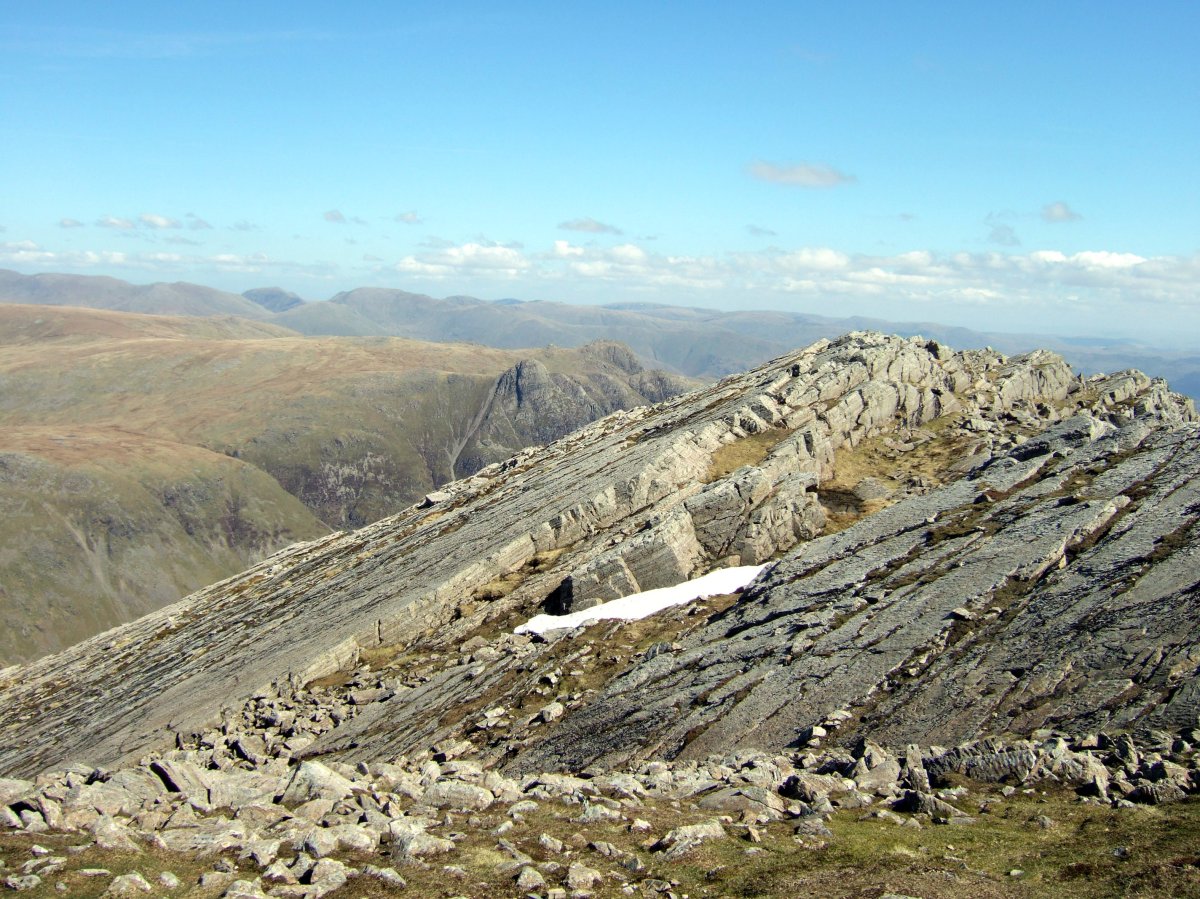
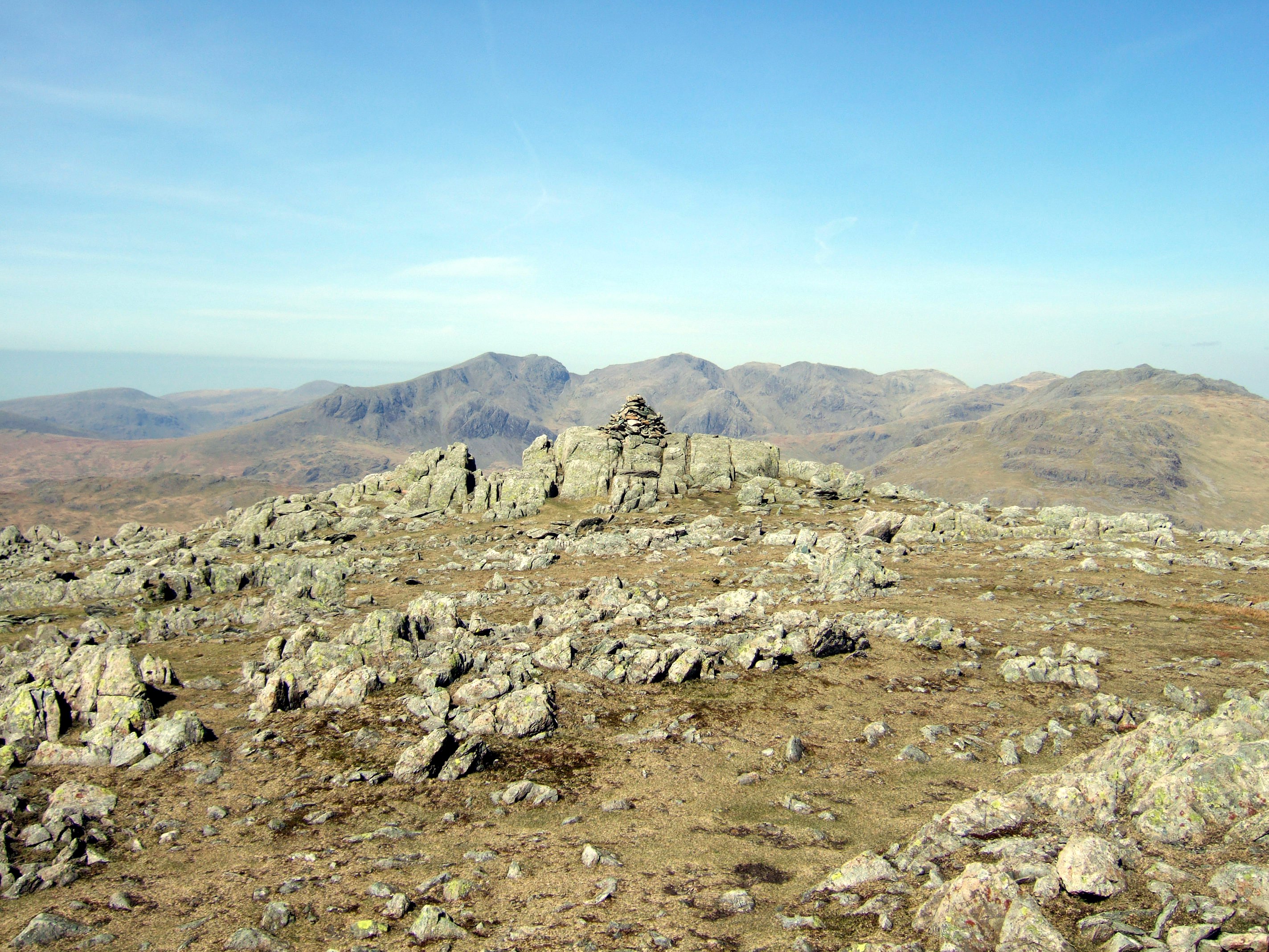
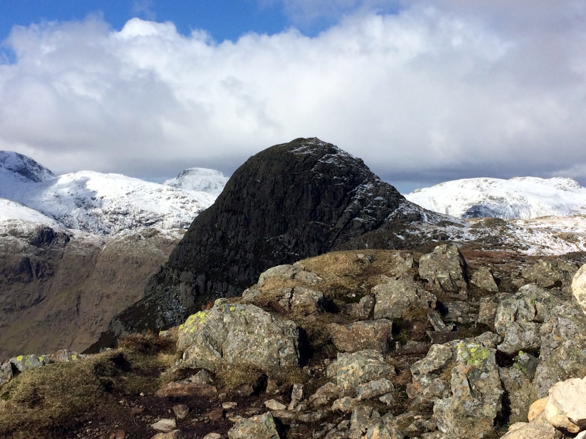
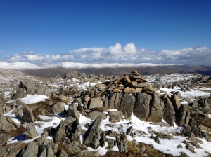
Re-joining the busy ridge route over Crinkle Crags we followed the stony path as it winds, rising and falling over each of the crinkles that give this mountain its name.  We did go over the Bad Step, but forgot to take any photographs.

Crinkle Crags and BowfellScafell and Scafell Pike

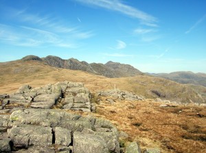
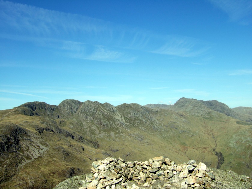
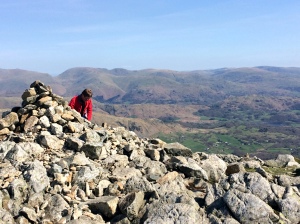
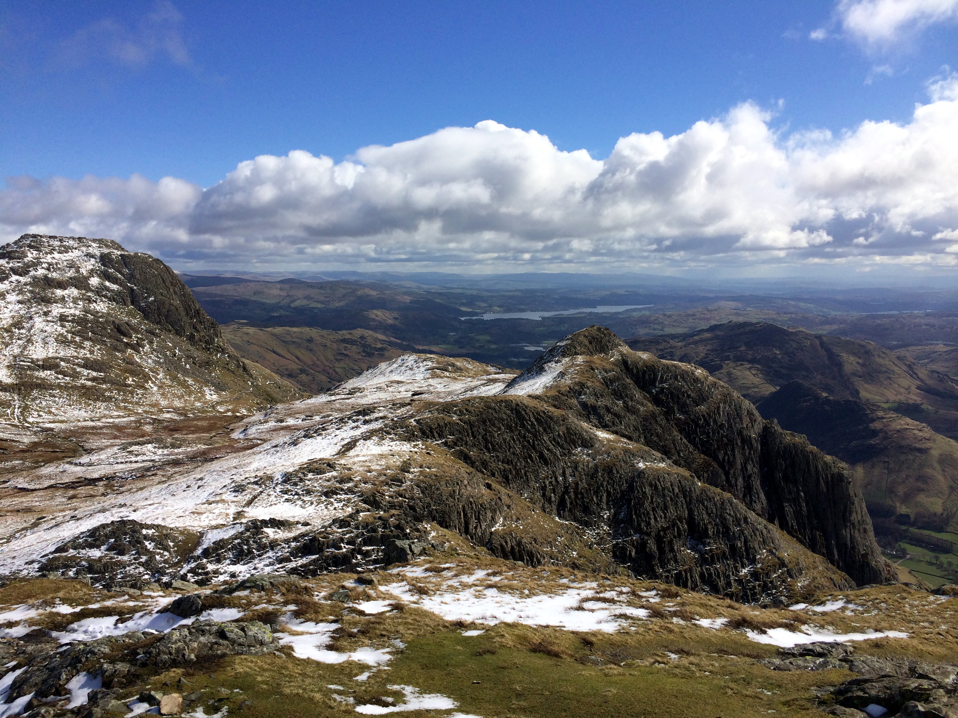
With tired legs we arrived at the foot of the eroded scree covered path to the top of Bowfell. The top of this very popular mountain was so crowded that each rock had someone standing on it, like a group of meerkats shoulder to shoulder trying to catch a glimpse of the view; and the view of the Scafell Pikes was magnificent.

Pike O'Blisco

Turning our backs on Bowfell and Crinkle Crags we walked back down to the valley via The Band looking at the sun shining on Pike O’ Blisco and Pike of Stickle (2,326ft/709m).


Route

From the Old Dungeon Ghyll car park (NY287061)

Bowfell Route

Wetherlam

Tuesday, 15 April 2014
7.70 miles/12.4km
3380ft/1030m ascent
Trail 100 #30
Wainwright #136

I love the names of these hills, Wetherlam (2,503ft/763m), Swirl How (2,631ft/802m), Grey Friar (2,536ft/773m); makes me wonder who named them and why.

Wetherlam

Starting at the foot of the Wrynose Pass we forded the River Brathay and crossed to the track running to the disused mine near Greenburn Beck.  The path shown on the map turned out to be a series of sheep tracks running across the rocky fell-side, and as we climbed the views of Pike O’Blisco (2,313ft/705m), Cold Pike (2,300ft/701m) and Crinkle Crags (2,818ft/859m) opened up; and the sun got hotter.

Waterfall

Once we reached the col we joined the obvious path over the crags to the top of Wetherlam. Despite the sunshine there was a strong breeze blowing and the air was cold.  Here you can see Lake Windermere, the Helvellyn range across the Langdale valley and the black cliffs of Swirl How, Brim Fell (2,612ft/796m) and The Old Man of Coniston (2,635ft/803m).

Wetherlam SummitSwirl How from Wetherlam

Our second climb of the day is the ascent of the craggy Prison Band to the summit of Swirl How, and the view changes to reveal Levers Water nestling at the foot of Brim Fell with Coniston Water and Morecambe Bay beyond.

Prison BandLevers Water, Coniston and Morecambe BaySwirl How

From Swirl How an expanse of grass drops away and then rises to the rock covered top of Grey Friar.  The view of Scafell (3163ft/964m), Scafell Pike (3,209ft/978m) and Dow Crag (2,552ft/778m), and down into Eskdale and Dunnerdale is spectacular and one of the best in the Lake District.

Scafell Pikes from Grey Friar We paused at the memorial for the crew of a Halifax bomber who died in a crash on Great Carrs (2,575ft/785m) during World War II, and then followed the ridge down, before the steep decent to the Wrynose Pass.

Plane Crash MemorialCloud

We sat in the warm sunshine and ate some food, watching a film crew recording a small part of a hill walking documentary film, the two presenters wearing full winter gear (for continuity) in the glorious afternoon sunshine.  We walked back down the road, stopping to photograph the Three Shires Stone, an old boundary marker showing where Lancashire used to extend far North before the county lines were re-drawn in the 1970s.

Three Shires Stone


Route

From the Wrynose Pass outside Little Langdale (NY292032)

Wetherlam Route

Langdale Pikes

Sunday, 23 March 2014
7.2miles/11.6km
2575ft/785m ascent
Trail 100 #26
Wainwright #126 & #127


A splendid day walking in the Langdales in the sunshine and snow.

From the New Dungeon Ghyll Hotel we walked up the steep fellside to Loft Crag (2231ft/680m) and all the time the views open up, first Crinkle Crags (2818ft/859m), then Bowfell (2959ft/902m) and the Coniston group in the distance.

Langdale Pikes - Crinkle Crags 
Langdale

Looking down the Great Langdale valley towards Lingmoor Fell (1539ft/469m) and Skelwith Bridge.


Loft CragLoft Crag

The first mountain on the route is Loft Crag where the rest of the route can be seen for the first time. The photo shows the rocky summit of Loft Crag with the spectacular crags of Pike of Stickle (2326ft/709m) appearing over the cairn in the background.

Pike of Stickle

This is the Trail 100 hill on this walk and the reason we chose this route. A truely spectaular mountain with a tricky scramble to the top when the rocks are covered with compacted snow.

Pike of Stickle 3Pike of Stickle 2

These two photos show the view of Loft Crag and Harrison Stickle (2415ft/736m); and celebrating reaching the top with the snow filled Harrison Combe behind.

Pike of Stickle - Loft Crag and Harrison Stickle Pike of Stickle 1

Harrison StickleHarrison Stickle

We scrambled down Pike of Stickle and crossed back to Harrison Stickle on the other corner of the Langdale Pikes. This gave us the first view of Stickle Tarn and our planned route down.

The photo also shows a heavy snow flurry which completely hid the summit of Helvellyn (3117ft/950m) but missed us completely.


Pavey ArkPavey Ark
The snow made finding the route from Harrison Stickle to Pavey Ark (2297ft/700m) a challenge. The top of Pavey Ark is not very impressive – it’s much better from Stickle Tarn. We ate lunch sitting on the rocks before setting off over the snow covered rocks and peat towards Thunacar Knott (2372ft/723m).

Thunacar KnottThunacar Knott

The summit of this mountain looks like a lunar landscape – rock strewn and windswept. The view to the West includes Glaramara (2569ft/783m) and Great Gable (2949ft/899m). The photo shows the snow topped Helvellyn ridge and Fairfield (2864ft/873m) to the East.

We followed the well worn path towards High Raise (2500ft/762m) which was covered in deep snow. My leg disappeared through the snow into a peat bog hidden beneath. Thank goodness for gaiters!

Sergeant ManSergeant Man 2

Sergeant Man (2415ft/736m)  is a prominent and easy to identify mountain with a very distinctive shape, and was the last mountain on our walk.

From the top we followed the ridge down towards Blea Rigg (1175ft/541m) before turning South West and descending to Stickle Tarn where the huge cliff of Pavey Ark casts a dark shadow over the lake.


Stickle Tarn

Pavey Ark from Stickle Tarn

Last resting point before descending the steep rocky staircase back to the Dungeon Ghyll and a nice cup of coffee.

Resting at Stickle Tarn 1Resting at Stickle Tarn 2


Route

Starting at the New Dungeon Ghyll car park  (NY296064).

Langdale Pikes Route