Sunday, 23 March 2014
7.2miles/11.6km
2575ft/785m ascent
Trail 100 #26
Wainwright #126 & #127
A splendid day walking in the Langdales in the sunshine and snow.
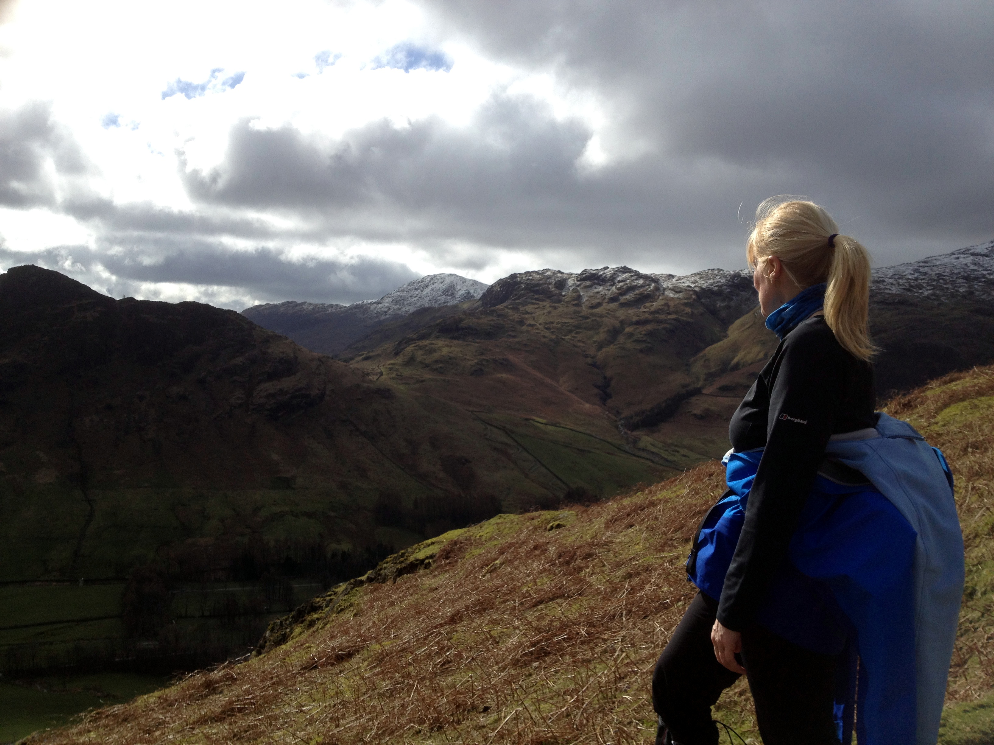
From the New Dungeon Ghyll Hotel we walked up the steep fellside to Loft Crag (2231ft/680m) and all the time the views open up, first Crinkle Crags (2818ft/859m), then Bowfell (2959ft/902m) and the Coniston group in the distance.


Looking down the Great Langdale valley towards Lingmoor Fell (1539ft/469m) and Skelwith Bridge.
Loft Crag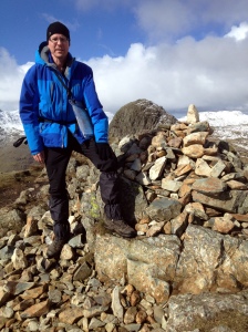
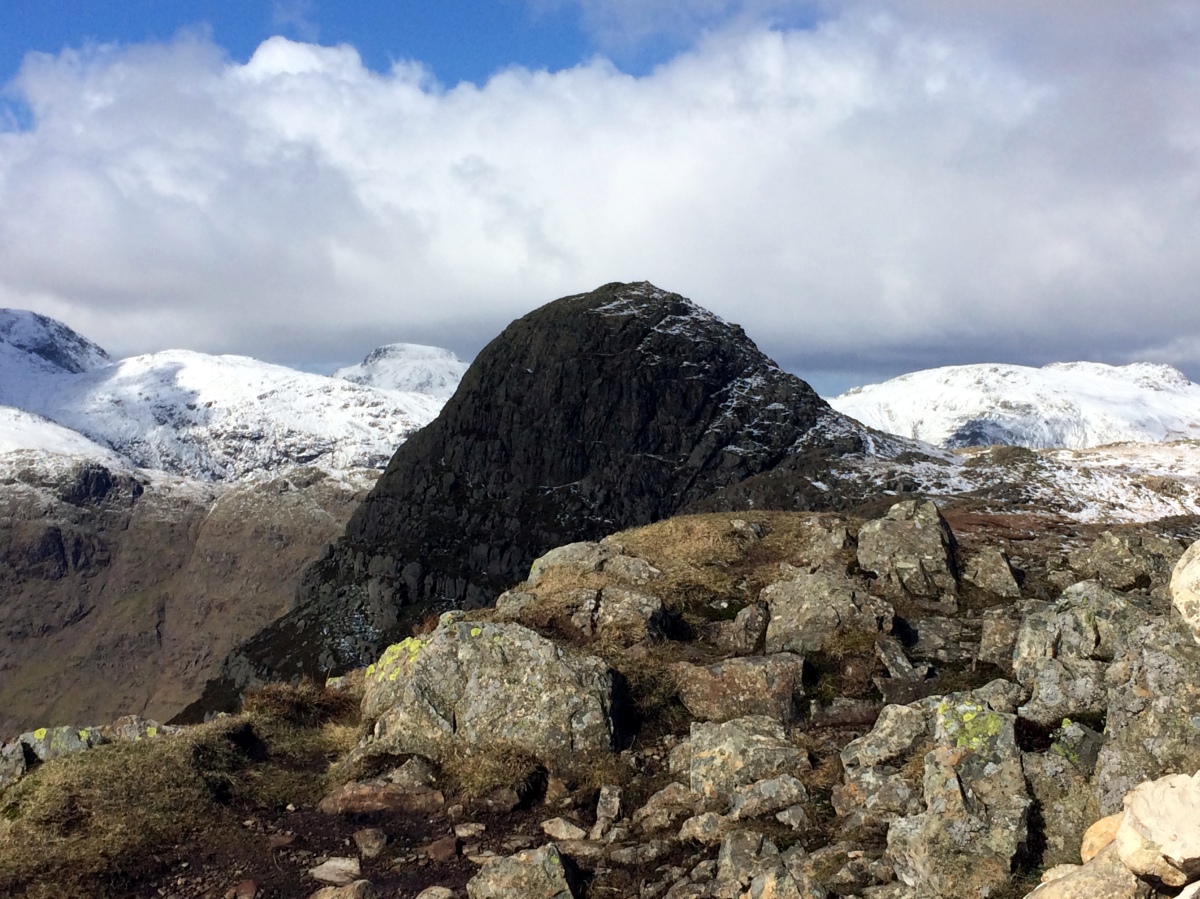
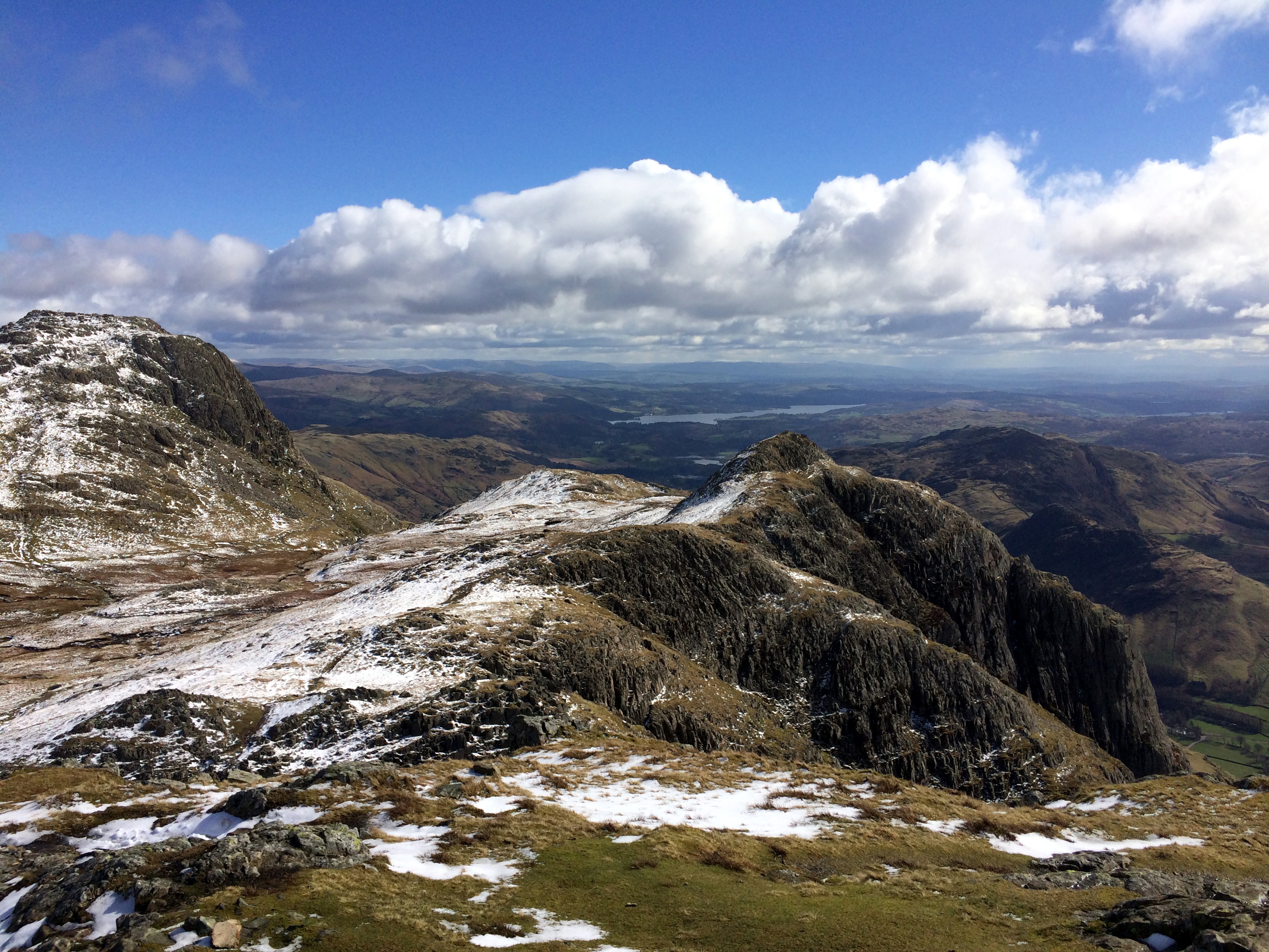
The first mountain on the route is Loft Crag where the rest of the route can be seen for the first time. The photo shows the rocky summit of Loft Crag with the spectacular crags of Pike of Stickle (2326ft/709m) appearing over the cairn in the background.
Pike of Stickle
This is the Trail 100 hill on this walk and the reason we chose this route. A truely spectaular mountain with a tricky scramble to the top when the rocks are covered with compacted snow.


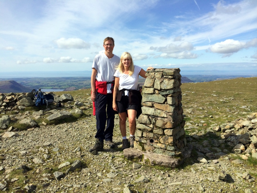
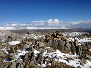
These two photos show the view of Loft Crag and Harrison Stickle (2415ft/736m); and celebrating reaching the top with the snow filled Harrison Combe behind.


 Harrison Stickle
We scrambled down Pike of Stickle and crossed back to Harrison Stickle on the other corner of the Langdale Pikes. This gave us the first view of Stickle Tarn and our planned route down.
The photo also shows a heavy snow flurry which completely hid the summit of Helvellyn (3117ft/950m) but missed us completely.
Pavey Ark
The snow made finding the route from Harrison Stickle to Pavey Ark (2297ft/700m) a challenge. The top of Pavey Ark is not very impressive – it’s much better from Stickle Tarn. We ate lunch sitting on the rocks before setting off over the snow covered rocks and peat towards Thunacar Knott (2372ft/723m).
 Thunacar Knott
The summit of this mountain looks like a lunar landscape – rock strewn and windswept. The view to the West includes Glaramara (2569ft/783m) and Great Gable (2949ft/899m). The photo shows the snow topped Helvellyn ridge and Fairfield (2864ft/873m) to the East.
We followed the well worn path towards High Raise (2500ft/762m) which was covered in deep snow. My leg disappeared through the snow into a peat bog hidden beneath. Thank goodness for gaiters!
Sergeant Man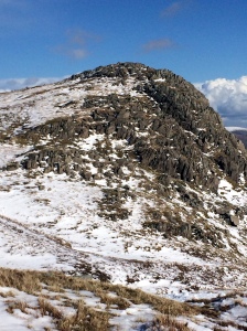
Sergeant Man (2415ft/736m) is a prominent and easy to identify mountain with a very distinctive shape, and was the last mountain on our walk.
From the top we followed the ridge down towards Blea Rigg (1175ft/541m) before turning South West and descending to Stickle Tarn where the huge cliff of Pavey Ark casts a dark shadow over the lake.
Stickle Tarn
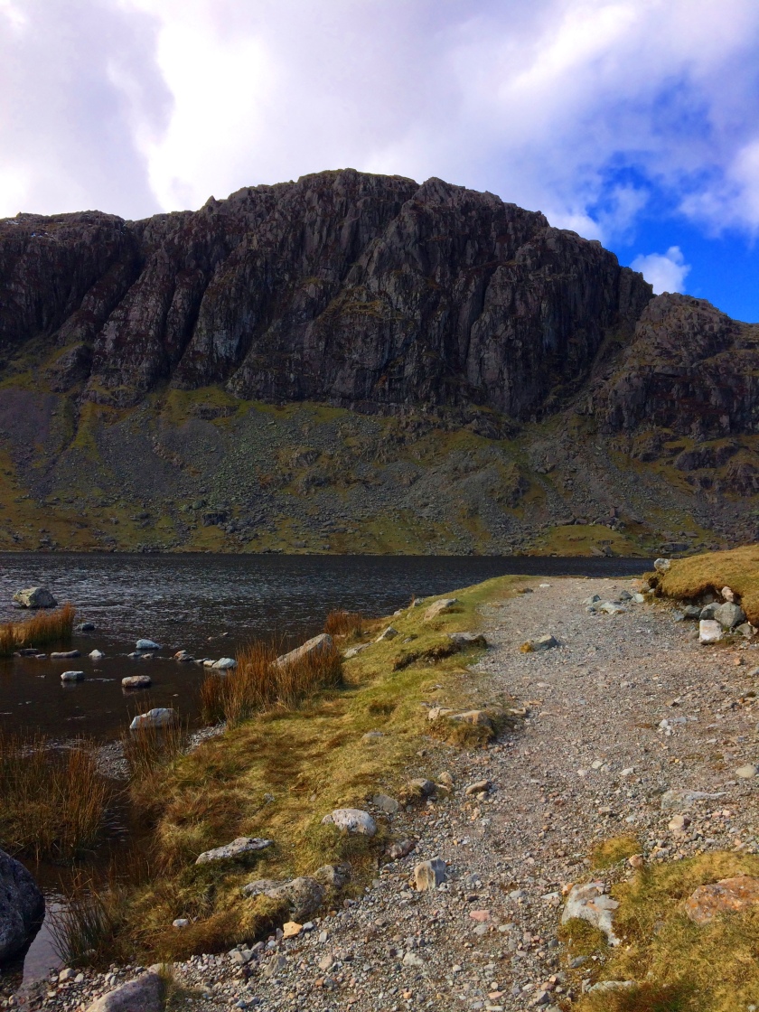
Last resting point before descending the steep rocky staircase back to the Dungeon Ghyll and a nice cup of coffee.


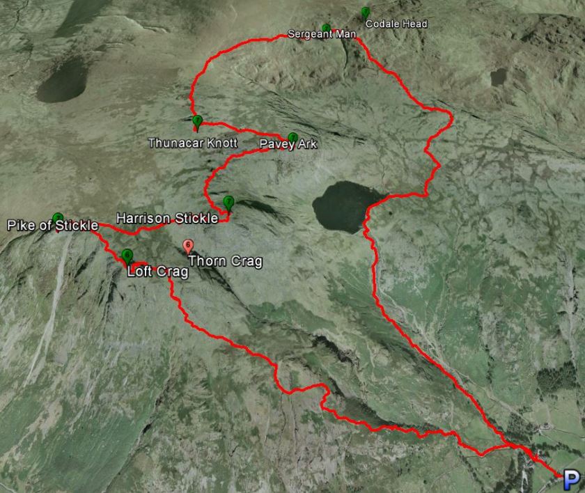
Route
Starting at the New Dungeon Ghyll car park (NY296064).